


chudy14
-
Posts
8 -
Joined
-
Last visited
-
Days Won
1
Everything posted by chudy14
-
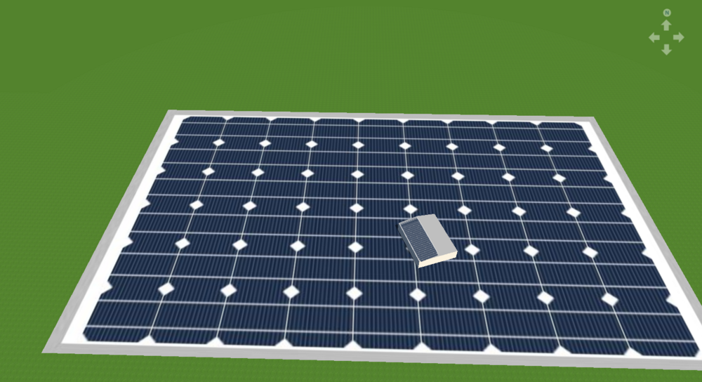
I’m sharing this because I spent hours struggling with bifaciality not being calculated correctly in my PV design, and I couldn't find a clear solution anywhere. I was designing a 4m tall carport canopy over a parking lot with asphalt. All my settings seemed correct: Bifacial modules with 70% bifacial gain Albedo set to 25% (asphalt) Properly configured mounted panel settings Yet, the bifacial gain on the back of the module remained at 0 kWh, no matter what I did. The Solution The missing step was creating a 3D polygon—specifically, an arbitrary open surface. Initially, I had placed the mounted panels on an Open Area generated from the map, but this setup didn’t allow bifaciality to be calculated unless the panel inclination was set to an extreme angle where direct sunlight hit the back panel (ignoring albedo effects). Once I switched to defining the area with a 3D polygon, the bifacial gain started calculating correctly. Key Takeaway If you're facing a similar issue, make sure your panels are mounted on a 3D-defined surface (arbitrary open surface) rather than just using a basic Open Area from the map. Hope this helps someone and saves them the frustration I went through!
-
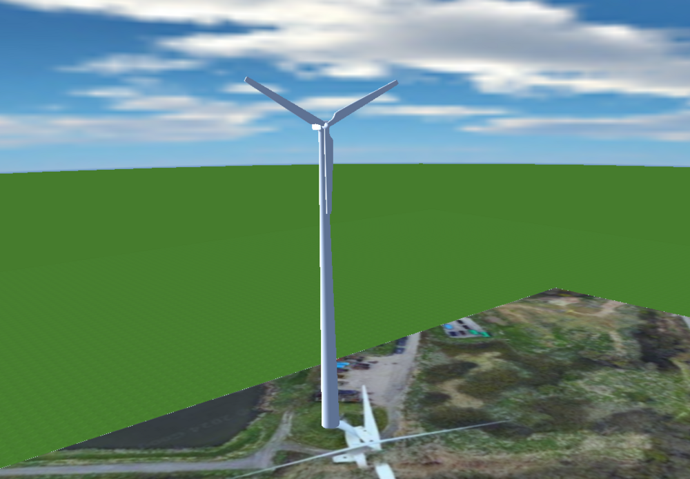
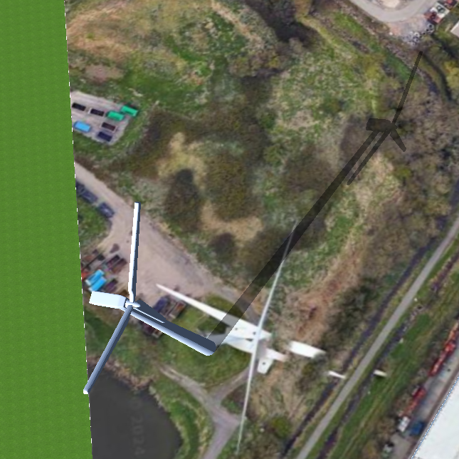
my pvsol just crushed, and asked me to use my backup, I said ok and this is what happened: Earth is not only flat, it's a solar panel too!
-
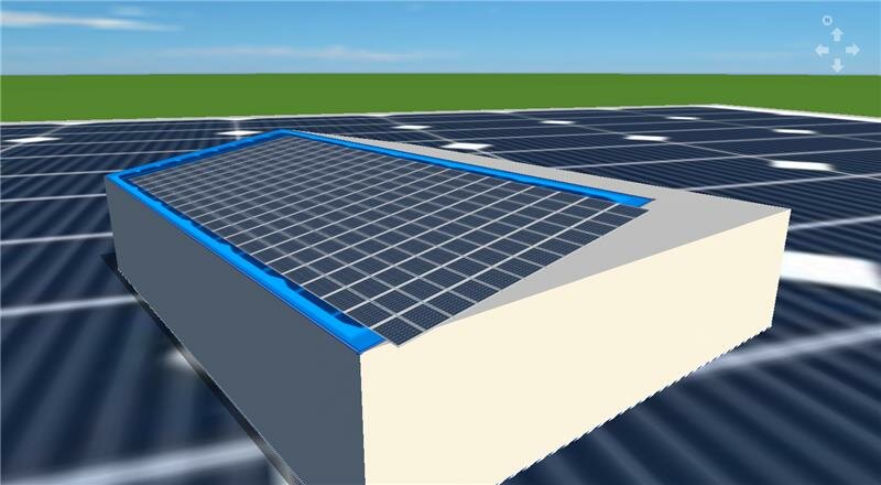
Made 3d object from sketchup into the PVSOL 3d modelling for proper shading, thought it is worth sharing with you!
-
Hi, sorry for re-heating the topic I have found a solution taht might help you with this. To produce 3d terrain I used SketchUp (geo location) it takes 30 seconds to produce as per this yt video https://www.youtube.com/watch?v=8jyc2CFolKY then you export it to .obj In pvsol in 3d you can simply add it if you use .obj instead of .3ds than it will save scale as well, from that point once you add it all you have to do is check box to say it is terrain model and you good to go Edit 02/08/2023 fixed scale of ground texture
-
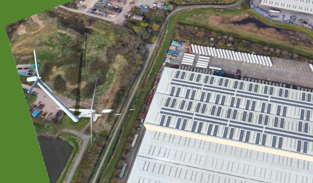
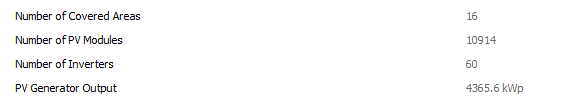
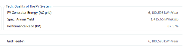
Update on this: With better pc it actually worked for Module Coverage but not for Mounted Modules for some reason, manage to complete project with 10914 modules on it and it crashed maybe twice (which I think is success!), I think if program would let me use my GPU to full extend (RTX 3080Ti) then there would be no problems but I am still happy with results I got! Below cropped pic. (due to nature of project I cannot show to much):
-
Thank you for reply! I tried that but unfortunately program crashes when autosaving, I am awaiting more powerful pc soon so will try again then. I will update you in future
-
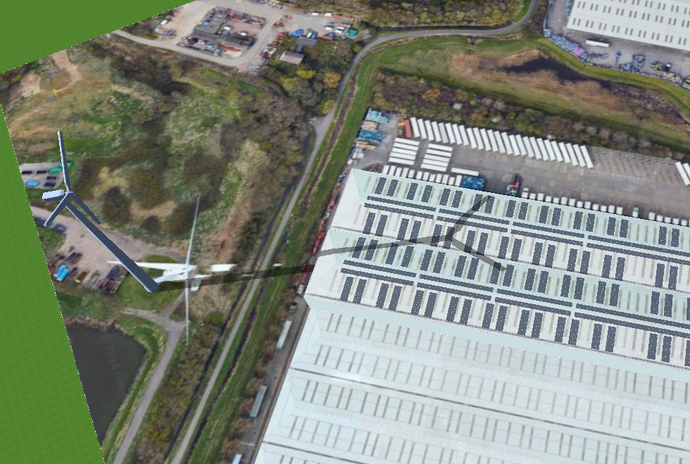
Hello, I am currently working on a project that have over 10,000 mounted panels on one roof. For simulation I did couple separate PVSOL projects (as program have limitations) but now I am asked to supply pictures from different angles for 3D model which is impossible in the PVSOL at the minute. Please share ideas how could this be approach? ps. for the aerial view I have combine pictures from all projects, but this is impossible if I do it in angle
-
Hi Jimmy, Great idea to use mounted system! I just recently completed carport desing based on this post. Thanks a lot!
.thumb.png.9a75421699fb1349d478d1d1ff7ff53c.png)
.thumb.png.7c933eb3834dd781af10786f5f8abd36.png)
.thumb.png.1a5729467570654de44bde351f2e89d8.png)


.png.4e3c23efecd9c4fe6cedcce711ec2502.png)
.png.ebc881aacfa1dd3c9f9380d734b6acab.png)
.png.66f02502fccb2535c45397eabd12bfdb.png)