Marta Gonçalves
-
Posts
26 -
Joined
-
Last visited
Marta Gonçalves's Achievements
")
Newbie (1/14)
0
Reputation
-
Thanks for the answer. I'll review this software and verify its applicability to the type of projects we develop. If we need training from you for data integration and processing, is that available to you? Wiith best regards, Marta Gonçalves
-
Good Morning, My company has purchased licenses to use your PVSol Premium software. Over the course of the work we have noticed that the tools available to design the buildings, based on the aerial images provided by the software lead to size errors, which on the ground when implementing photovoltaic projects require a redesign of the entire solution previously sold, sometimes at high extra costs. I would like to see with you a software integration solution that would allow the integration of a DRONE air survey. Do you have any solutions you can recommend? I would like to ask you if you know or have any kind of integration for the elements collected by DRONE, and if you can you give us training on data integration and how we work on it (accurately recognize geographic location and data height of obstacles and areas collected)? We have a lot of urgency in this information because we are developing projects with some specifics. I look forward to a brief contact from you.
-
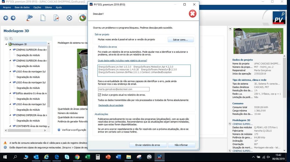
I tried again, to do the energy simulation and reappeared the error report
-
I have been all morning and part of the afternoon trying to do the energy simulation of 1 project in PVSol, and whenever I request the Report, the program crashes and shuts down automatically. The program have already sent 2 reports and the problem persists. I need to do an energy analysis of this simulation and see no way to overcome this bug.
-
Hello, I'm working on a PV project on the PV Sol software and, halfway through the job, the image of the place disappeared and this message, in attachement, appeared to me. I have already started the project 2 times and every time I try to delete modules or other objects, I get the information of the "bug report".
-
I do not know what's happening but now when I try to attach a photo, I automatically see the following information: "You can only upload a total of 0 MB. Please contact us for assistance".
-
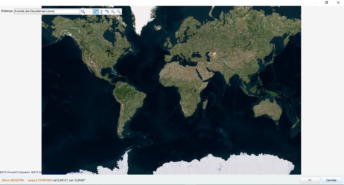
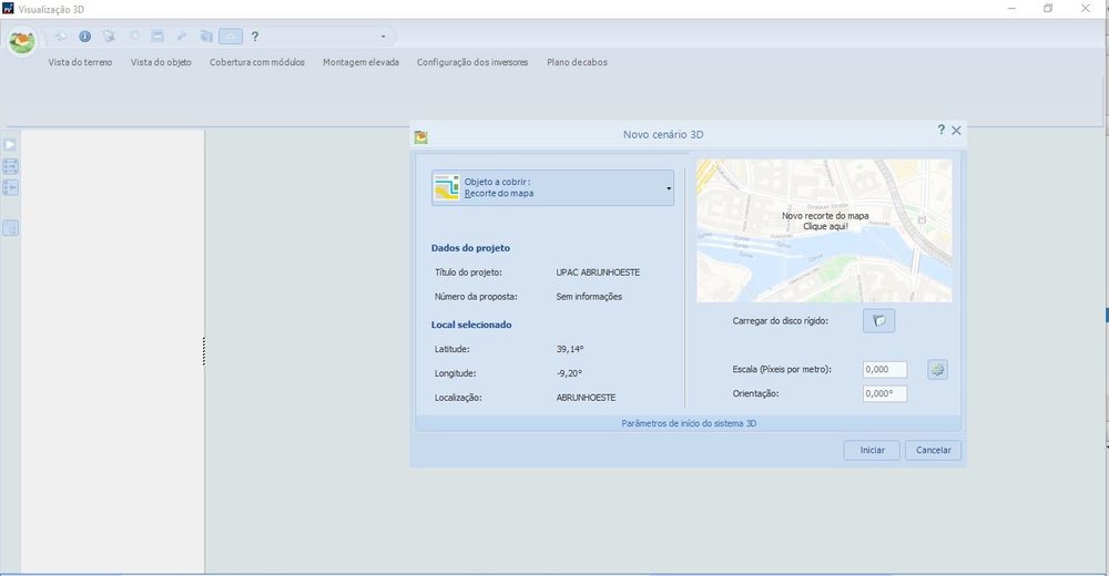
Hello Marcel, To simplify the procedure, I open a new project and in the "Type of system, climate and network" page I will create a new location in the Climatic Data. As I do the Search area I put the name of the place and the information (square indicated in the attached image) shows that "nothing was found". At this point I have to go manually looking for the place (which becomes a difficult task because I do not have landmarks) with the help of the Google Earth program. After defining the new location with the meteorological data, we continue to the "3D Modeling" page and click on EDIT. A new window called "New 3D Scenery" appears, where I choose the "Map Clipping" option. When opening the window with Bing Maps it is always located off the coast of Africa, and it is necessary to manually find the place I want.
-
-
Good afternoon, A few weeks ago I mentioned that geolocation was'nt working correctly. After your answers I got it working fine, but now the problem has returned. I'm starting a new project and when I do the 3D modeling, the image (after the System Type and Climate definition) returns to positioning itself off Africa. Can you solve this bug permanently? Thanks, MG
-
if you do not want to send the email here, send me a message to: marta.goncalves@sotecnisol.pt
-
Hi Hi I can send the project with no problem. The point is that by here the limit is 160 kb. Can you send me an email to which I can resend sketchup? Best regards, Marta Gonçalves
-
Hi Thank you for your help. Can you give me an email address to send the project? Through this forum the attachments can have a maximum of 163 kb. Best regards, Marta Gonçalves
-
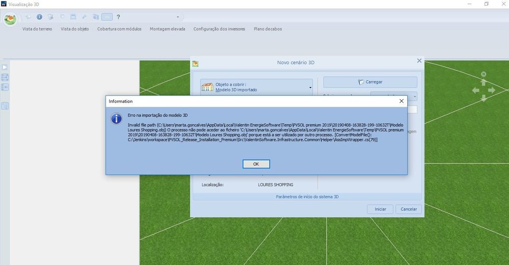
Good afternoon, Today has been a great day with situations in PVSol !!!!! I'm trying to import 1 SketchUp 3D model and PVSol always gives me the same information. I have already recorded the Sketchup project several times and imported it into PVSol, as well as restarted the PVSol a number of times, but always without success.
-
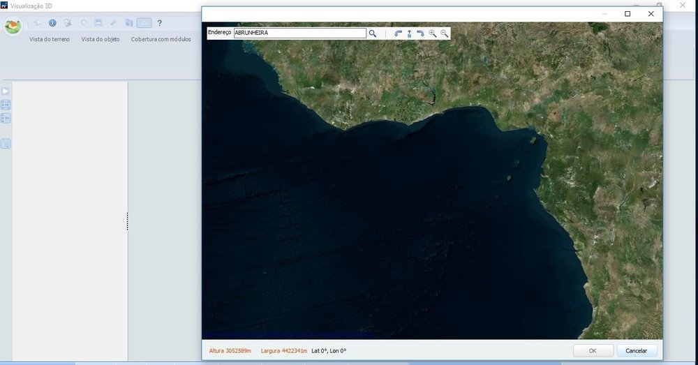
HeHi again, I tried again with a new project, and it still does work. I set the location of my study and when I go to 3D Modeling and select "Trim Map", geolocation does not work. The screen appears totally dark and when zooming out the image is located throughout Africa.

-
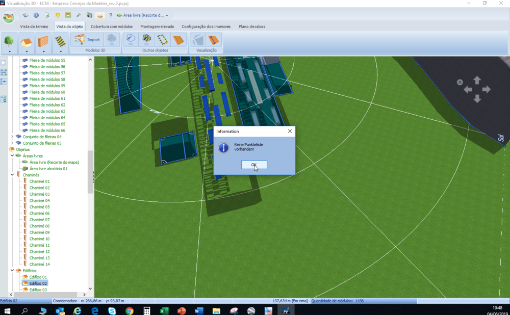
Another situation with the Geolocalization of PVSol. When defining the study site, and when the area of the object is extensive, PVSol does not allow the entire area of the object to be analyzed. As the attachment indicates, for the specific case that I report the "OK" button is not active for the entirety of my object. Just zooming in, I can crop my object, but I do not have the total area I need.