


Boris
-
Posts
20 -
Joined
-
Last visited
Boris's Achievements
")
-
Dear Sirs I would like to ask if there is a way to simulate a 3D PV plant with a tracker system... Regards, Boris
-
Martin, Thank you for your help. I´ve already contacted with the Technical Support and I´m waiting for their response. Regards, Boris.
-
Dear Team: Today I wanted to work with my PVSol Premium 2016, but I had the terrible surprise that my program´s test period was over... That was very odd, because I have a license... What can I do??? Best Regards, Boris.
-
Martin, Thanks a lot for your answer (again...) Best regards, Boris.
-
Hi guys! Is it possible to connect the modules to a string manually? Thanks in advance. Regards Boris
-
Thank you again Martin. Kind regards, Boris
-
Dear Team: I need to limit the feed-in power at the conection point and I don´t sure if the Máximum feed-in Power Clipping is the tool for that. For example, if I have a 100 kW PV plant for use in own consumption and I have a feed-in limit of 25 kW, then would I have to put the Máximum Feed-in Power Clipping in 25% of PV Power at the feed in point? Thanks a lot. Regards, Boris
-
Thanks a lot Martin.
-
Thank you Martin. What happens if I don´t have the program serial number or other information? ¿Could be tracked only with my name? Regards, Boris.
-
Hi guys, I have a very serious problem. My hard disk was completely damaged, so I can`t run PVSol Premium anymore... What are the steps for this case???, What can I do to recover my license??? Please, I beg for your answer as son as possible... Thanks. Boris.
-
Hi Martin, thanks for your reply. The point is that it is difficult to get the elevation value..., it´s easier for the azimuth angle using a compass image overlay. I´ve been trying with the viewshed tool in GE Pro, but it´s a tedious process. I think there must be an easier and simple way to obtain that data, so if someone else have an idea about it, it would be an excellent share. I leave some images from GE. Best regards, Boris.
-
Hi, Is it possible to use the horizon line from the 3D images of Google Earth for the shadowing effect on the pv generator? Thanks. Regards, Boris
-
Thank you for your replay. I´ll be waiting the improvements in the next program versions. Best Regards, Boris.
-
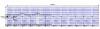
Hi friends: I would like to ask about some improvements in the Dimensioning Plan. As you can see in the picture below it is almost impossible to understand the measures for the pv generator. Is there a way to improve that? I think is a very good tool for the design and it is a shame that unusable... Best regards, Boris
-
Ok!, thank you for your reply! Best Regards, Boris.
